I have posted the February Montana Water Supply Outlook Report. It can be viewed on the Nevada Creek – Water Supply Data page.
The January & February WSOR’s do not contain the usual official streamflow forecasts. Last week, I spoke with Lucas Zukiewicz from NRCS about this. His response was that due to the low level of accuracy for these early season forecasts, they determined that publishing them was counter-productive for future water use planning. They will again publish official streamflow forecasts beginning with the March WSOR.
In the meantime, on the Water Supply Data page, I have added links to the unofficial Daily Guidance Forecasts for Nevada creek if anyone is interested. These graphs are updated daily based stricktly on Snotel data, and do not consider current climate trends & weather forecasts as with the official WSOR forecasts. But they do provide a good general idea of coming streamflows.
Lucas also forwarded me some interesting charts (below) comparing our current snowpack (s.w.e.) on Nevada Ridge with previous years (it should be noted that these snotel records only go back to the early 1990’s). Chart 1 ranks the top levels of snow water equivalent recorded on February 16th of each water year. Chart 2 ranks the highest peak s.w.e. for the water year and what date that level occurred.

Lucas also forwarded a current Non-Exceedence Projection for s.w.e. on Nevada Ridge (click to enlarge)…
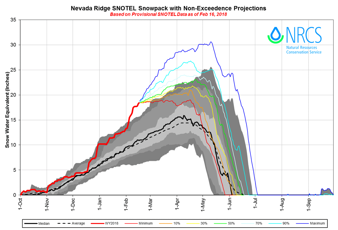
The short summary is that we can anticipate some heavy streamflows this spring.